- الرئيسية
- قارمن GPSMAP 66i GPS محمول ومتصل عبر الأقمار الصناعية Garmin GPSMAP 66i GPS Handheld and Satellite Communicator
قارمن GPSMAP 66i GPS محمول ومتصل عبر الأقمار الصناعية Garmin GPSMAP 66i GPS Handheld and Satellite Communicator
2542 ر.س
3003 ر.سالحق عليه باقي 8 فقط - اطلبه الآن
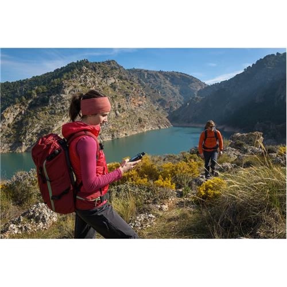
المزيد من المغامرات. أقل قلقًا.
يلبي التنقل الدقيق الاتصالات العالمية في جهاز GPS المحمول المتين GPSMAP 66i الذي يعمل بالزر GPS وجهاز الاتصال عبر الأقمار الصناعية 1 والذي يتميز برسم خرائط Garmin TopoActive وتكنولوجيا inReach.
أعرف الطريق
دعم MULTI-GNSS
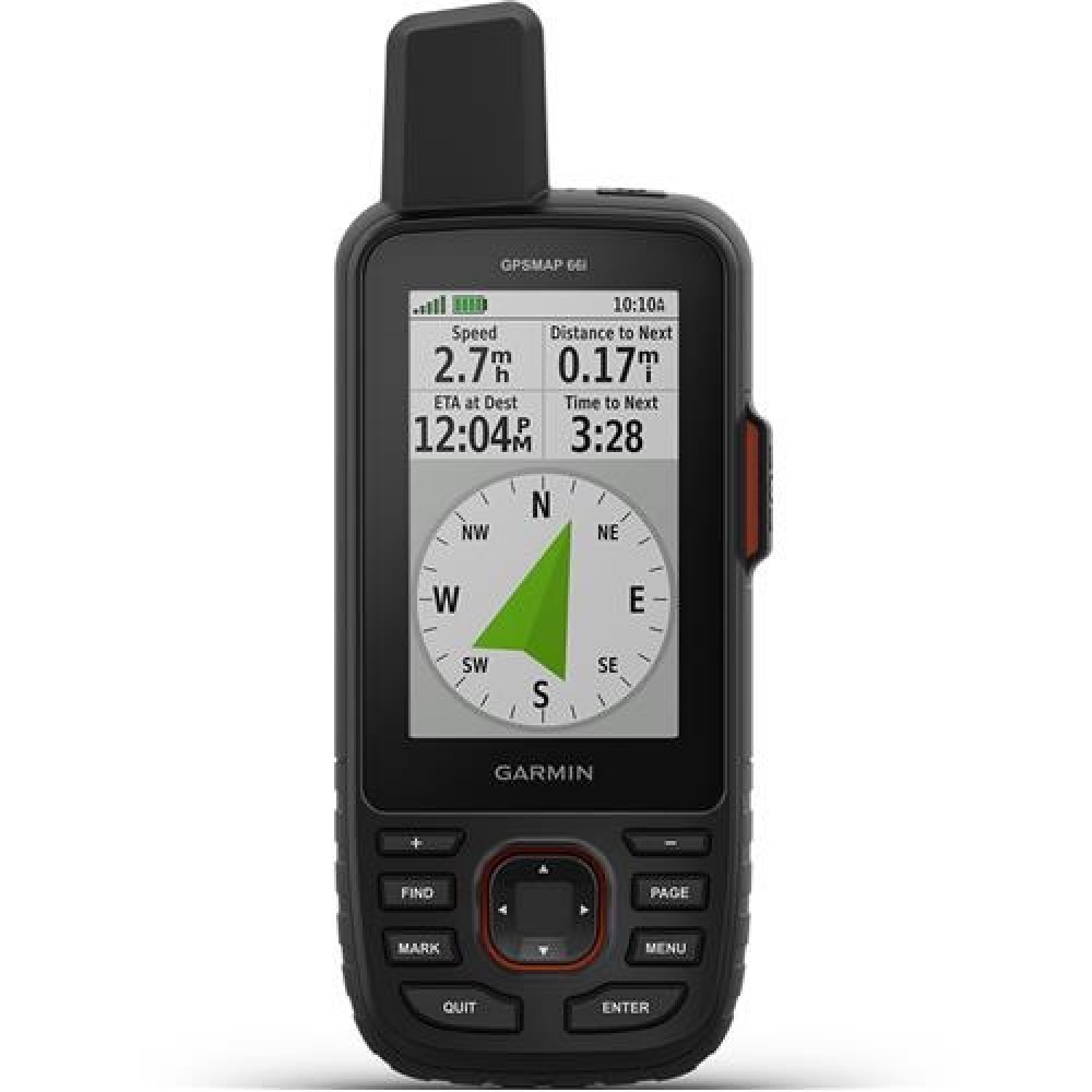
قم بالوصول إلى العديد من أنظمة الملاحة العالمية عبر الأقمار الصناعية (GPS و GLONASS) للتتبع في بيئات أكثر تحديًا من نظام GPS وحده.
مجسات ABC
تنقل في كل مسار باستخدام مستشعرات ABC ، بما في ذلك مقياس الارتفاع لبيانات الارتفاع ومقياس الضغط لمراقبة الطقس والبوصلة الإلكترونية ثلاثية المحاور.
صور الأقمار الصناعية Birdseye
قم بتنزيل خرائط صور واقعية عالية الدقة مباشرة على جهازك بدون اشتراك سنوي. يمكنك بسهولة العثور على الممرات واختيار مواقع الحامل والعثور على موقف للسيارات وإنشاء نقاط الطريق والمزيد.
خرائط Topo مسبقة التحميل
تُظهر لك خرائط TopoActive الأمريكية وكندا المُحمَّلة مسبقًا معالم التضاريس والارتفاعات الطبوغرافية والقمم والمتنزهات والسواحل والأنهار والبحيرات والنقاط الجغرافية.
مسارات Wikiloc
يتيح لك هذا التطبيق المحمّل مسبقًا تنزيل مسارات المشي لمسافات طويلة وركوب الدراجات ومسارات Wikiloc الأخرى التي يشاركها عشاق الهواء الطلق مثلك بسهولة. احصل على نسخة تجريبية مجانية من Wikiloc Premium لمدة 60 يومًا لتجربة هذه الميزة وغيرها من الميزات الحصرية.
ابق على اتصال باستخدام تقنية inReach
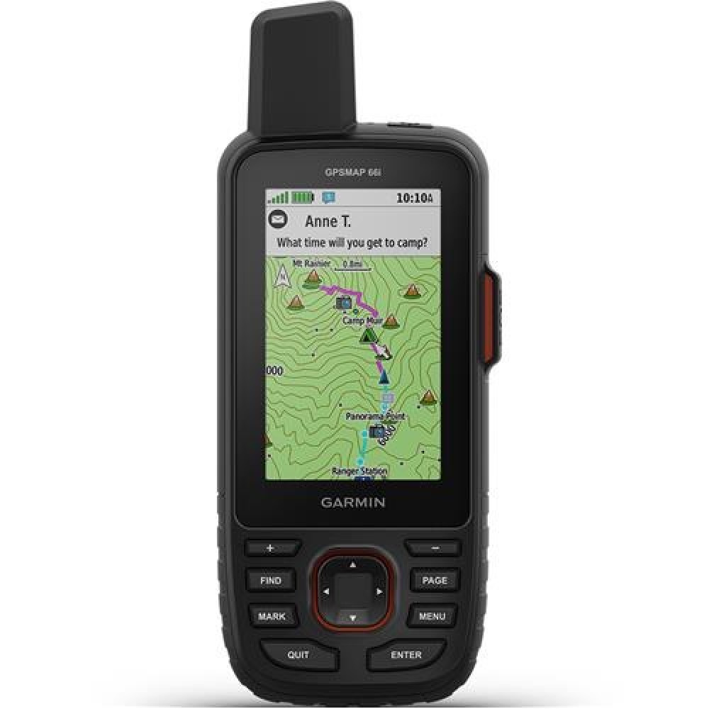
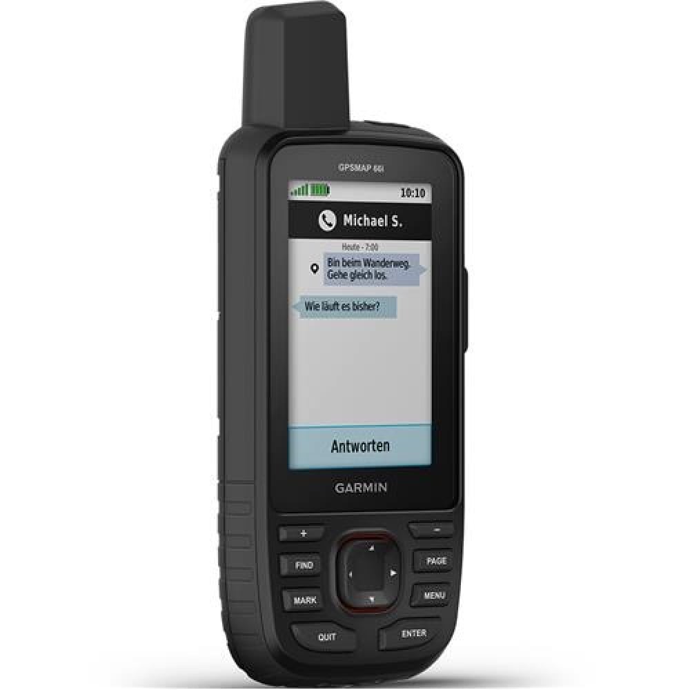
رسائل ثنائية الاتجاه. تبادل الرسائل النصية مع الأحباء ، أو النشر على وسائل التواصل الاجتماعي ، أو التواصل من inReach to inReach in the field (يلزم الاشتراك في القمر الصناعي).
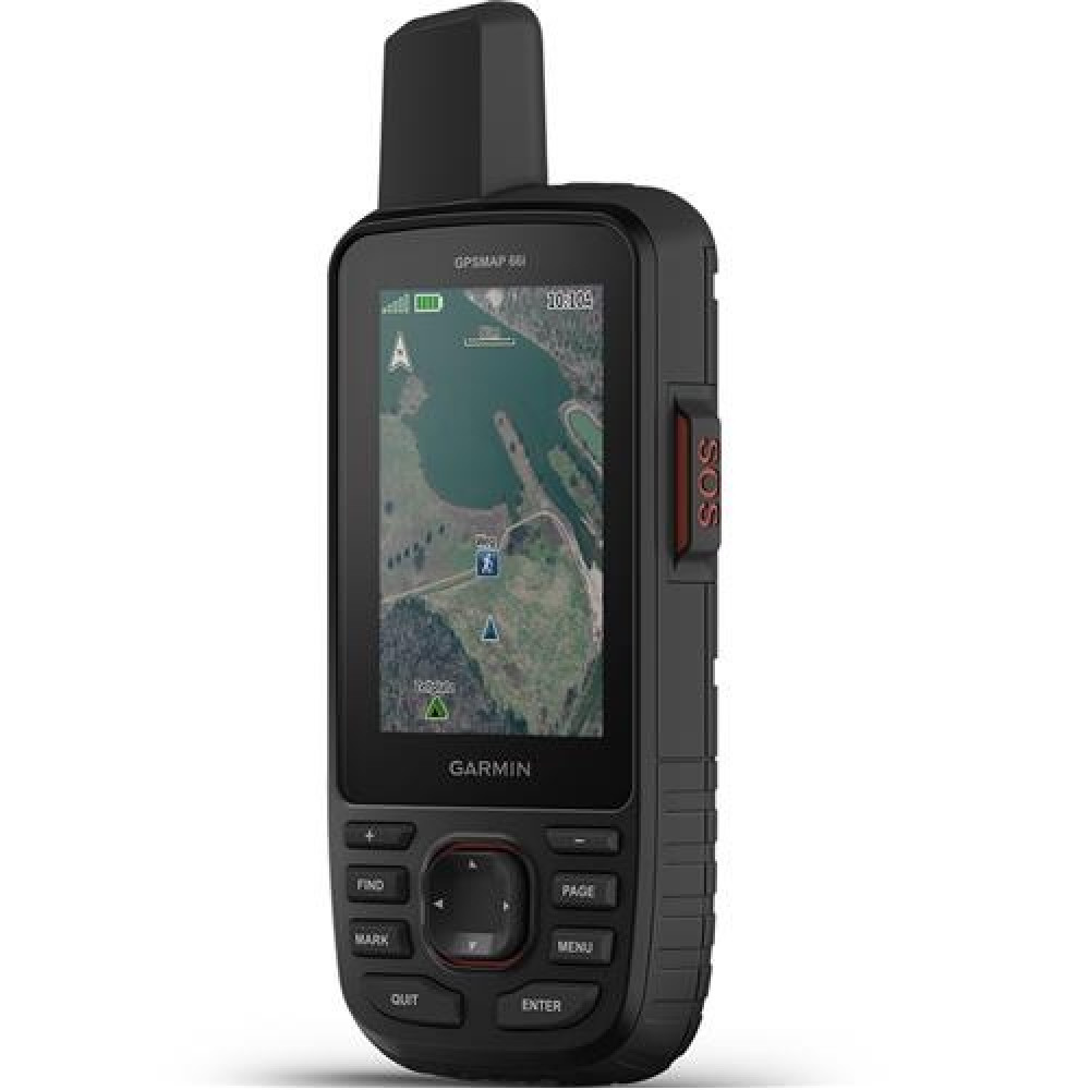
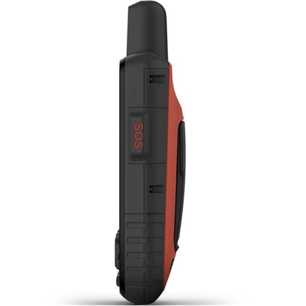
تنبيهات تفاعلية SOS
في حالة الطوارئ ، قم بتشغيل رسالة SOS تفاعلية إلى GEOS ، المركز الدولي لتنسيق الاستجابة لحالات الطوارئ (IERCC) الذي يعمل بالطاقة من Garmin مع مركز مراقبة واستجابة عالمي محترف يعمل على مدار الساعة طوال أيام الأسبوع (يلزم الاشتراك في القمر الصناعي).
مشاركة الموقع
تتبع موقعك ، وشاركه مع من في المنزل أو في الميدان. سيكونون قادرين على رؤية تقدمك أو اختبار اتصال جهازك لموقع GPS الخاص بك والمزيد (يلزم الاشتراك في القمر الصناعي).
100٪ شبكة الأقمار الصناعية إيريديوم العالمية
بدلاً من الاعتماد على تغطية الهاتف المحمول ، يتم الآن نقل رسائلك وتنبيهات SOS والتتبع عبر شبكة القمر الصناعي Iridium العالمية (يلزم الاشتراك عبر الأقمار الصناعية).
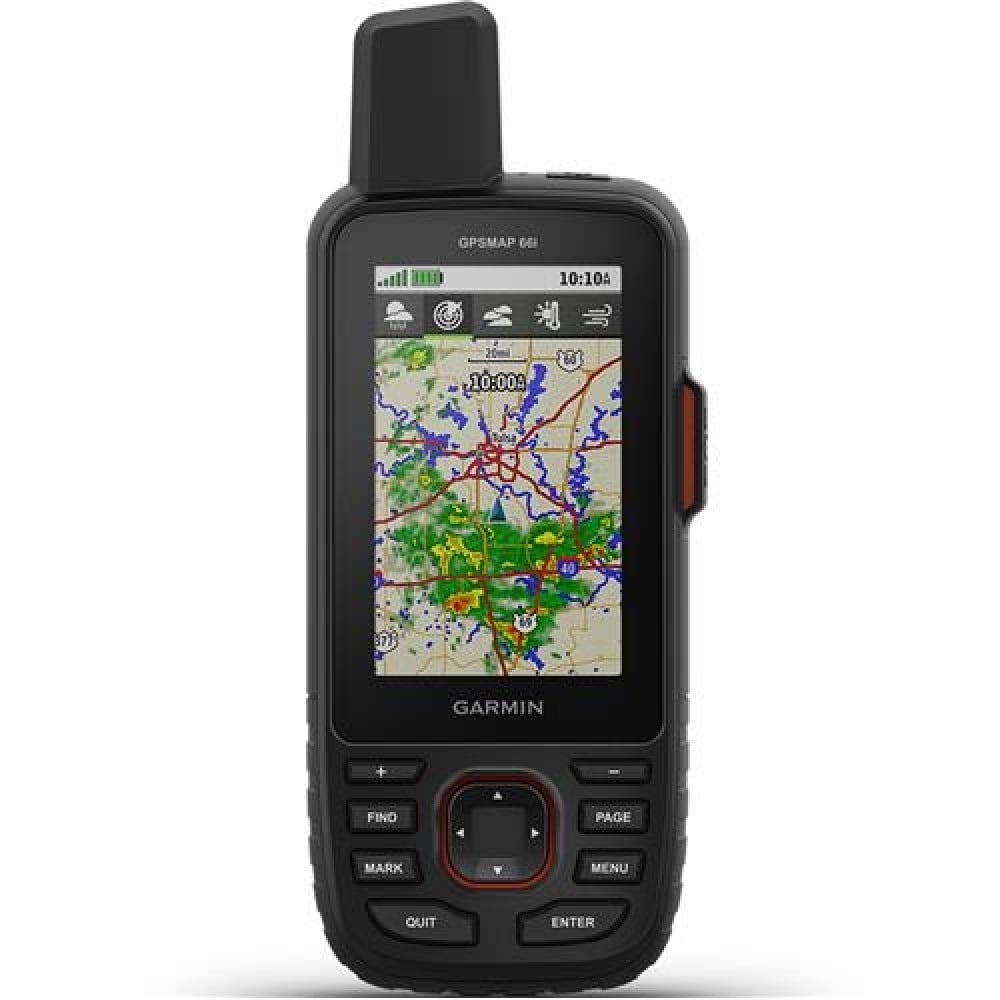
اختياري Inreach Weather
استخدم اتصال inReach للحصول على تحديثات مفصلة عن حالة الطقس على GPSMAP 66i أو جهاز متوافق مقترن بتطبيق Garmin Explore. اطلب تنبؤات الطقس لموقعك الحالي أو نقاط الطريق أو الوجهات على مسارك.
الطقس النشط
عند الاقتران بهاتفك الذكي المتوافق ، يمكنك الحصول على معلومات تنبؤ في الوقت الفعلي ورادار مباشر للطقس ، حتى تكون دائمًا على دراية بالظروف المحيطة.
كن مستعدًا للمغامرة
بنيت للمغامرة
تم تصميم هذا الجهاز المحمول يدويًا وفقًا للمعايير العسكرية للأداء الحراري والصدمي والمائي (MIL-STD-810) ، وهو متوافق أيضًا مع نظارات الرؤية الليلية.
مصباح يدوي LED
تساعدك سلسلة GPSMAP 66 على الحفاظ على السرعة إلى الحد الأدنى باستخدام مصباح يدوي LED مدمج يمكن استخدامه كمنارة للإشارة لطلب المساعدة.
تطبيق Garmin Explore
قم بتخطيط ومراجعة ومزامنة الإحداثيات والمسارات والمسارات باستخدام تطبيق وموقع ويب Garmin Explore للأجهزة المحمولة. يمكنك حتى مراجعة الأنشطة المكتملة أثناء وجودك في الميدان.
عمر البطارية
قم بتشغيل وضع الاستكشاف ، واحصل على ما يصل إلى 200 ساعة من عمر البطارية أثناء استخدام تقنية inReach. في وضع التتبع الافتراضي ، تحصل على ما يصل إلى 35 ساعة من عمر البطارية ، وسيحفظ جهازك موقعك كل 10 دقائق.
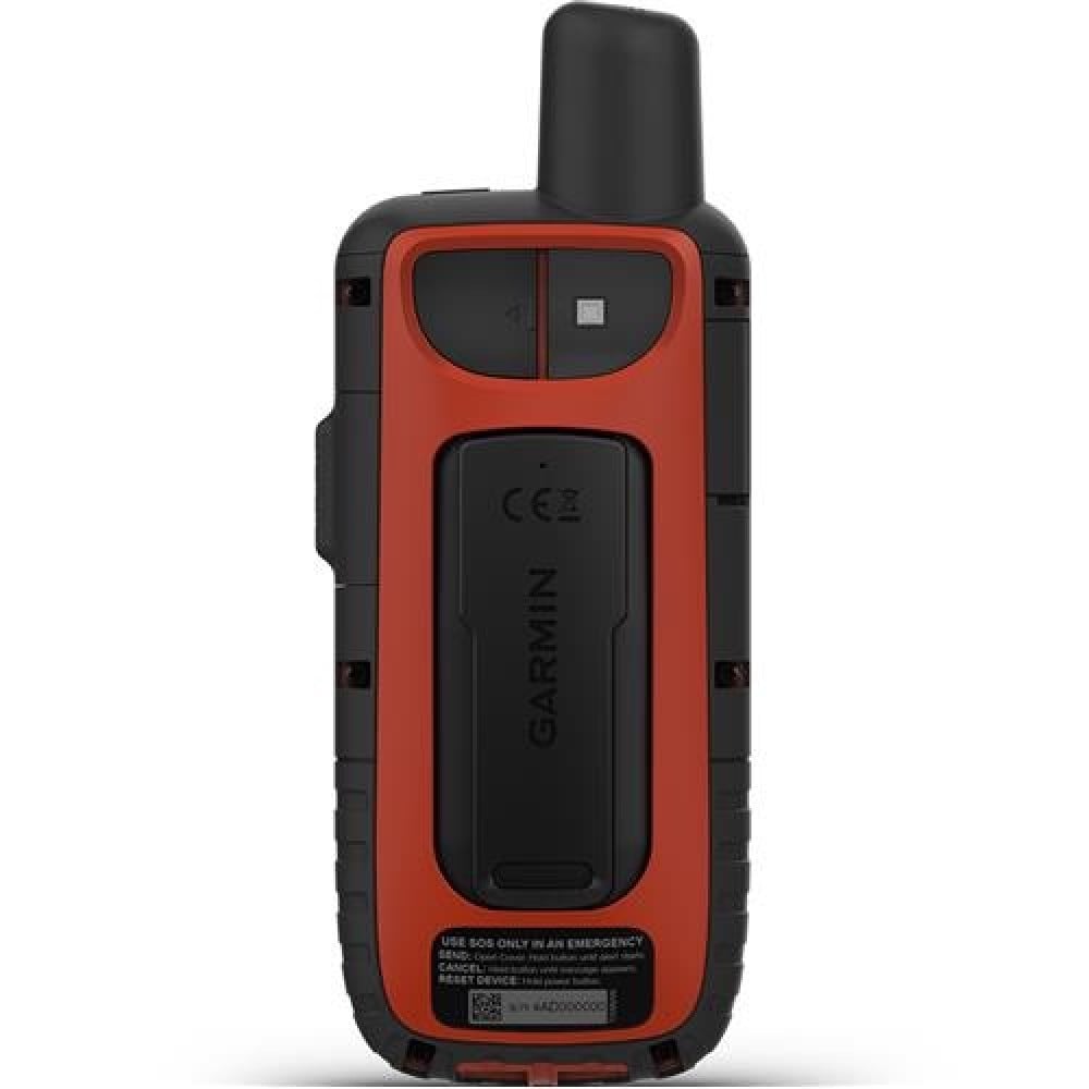
ماذا في الصندوق:
- جهاز الاتصال GPSMAP 66i GPS محمول باليد والأقمار الصناعية
- الوصول إلى صور القمر الصناعي Birdseye
- كابل USB
- مقطع حلقة تسلق
- وثائق
More Adventure. Less Worry.
Precise navigation meets global communication in the rugged GPSMAP 66i button-operated GPS handheld and satellite communicator1 featuring Garmin TopoActive mapping and inReach technology.
Know the way
MULTI-GNSS Support
Access multiple global navigation satellite systems (GPS and GLONASS) to track in more challenging environments than GPS alone.
ABC Sensors
Navigate every trail with ABC sensors, including an altimeter for elevation data, barometer to monitor weather and 3-axis electronic compass.
Birdseye Satellite Imagery
Download high-resolution, photo-realistic maps directly to your device without an annual subscription. Easily find trails, pick stand locations, find parking, create waypoints and more.
Preloaded Topo Maps
Preloaded TopoActive U.S. and Canada maps show you terrain contours, topographic elevations, summits, parks, coastlines, rivers, lakes and geographical points.
Wikiloc Trails
This preloaded app lets you easily download hiking, cycling and other Wikiloc trails shared by outdoor enthusiasts like you. Get a free 60-day Wikiloc Premium trial to try this and other exclusive features.
Stay in touch by using inReach technology
Two-Way Messaging. Exchange text messages with loved ones, post to social media, or communicate from inReach to inReach in the field (satellite subscription required).
Interactive SOS Alerts
In case of emergency, trigger an interactive SOS message to GEOS, the Garmin-powered International Emergency Response Coordination Center (IERCC) with professional 24/7 global monitoring and response center (satellite subscription required).
Location Sharing
Track your location, and share it with those at home or out in the field. They'll be able to see your progress or ping your device for your GPS location and more (satellite subscription required).
100% Global Iridium Satellite Network
Instead of relying on cellphone coverage, now your messages, SOS alerts and tracking are transferred via the global Iridium satellite network (satellite subscription required).
Optional Inreach Weather
Use inReach connectivity to get detailed weather updates on GPSMAP 66i or a compatible device paired with the Garmin Explore app. Request weather forecasts for your current location, waypoints or destinations on your route.
Active Weather
When paired with your compatible smartphone, you can get real-time forecast information and live weather radar, so you're always aware of the surrounding conditions.
Be adventure ready
Built For Adventure
This handheld is built to military standards for thermal, shock and water performance (MIL-STD-810), and it's even compatible with night vision goggles.
LED Flashlight
The GPSMAP 66 series helps you keep gear to a minimum with a built-in LED flashlight that can be used as a beacon to signal for help.
Garmin Explore App
Plan, review and sync waypoints, routes and tracks by using the Garmin Explore mobile app and website. You can even review completed activities while still in the field.
Battery Life
Turn on Expedition mode, and get up to 200 hours of battery life while using inReach technology. In the default tracking mode, you get up to 35 hours of battery life, and your device will save your location every 10 minutes.
What's in the box:
- GPSMAP 66i GPS Handheld and Satellite Communicator
- Access to Birdseye Satellite Imagery
- USB Cable
- Carabiner Clip
- Documentation

استكشف اكبر تشكيلة واشتري من معدات الغوص والتصوير والهايكنق والتخييم والقيمنق والالكترونيات وملحقاتها، تسوق آمن، شحن سريع، وسائل دفع متنوعة، كل هذا في اكسجين وهيليوم.